
When it comes to breaking ground on any construction project, the unseen can often be the most daunting challenge. At 2M General Engineering, we believe in making the invisible, visible. Our utility mapping services are designed to equip you with the critical information needed to navigate below the surface with precision and confidence.
What is Utility Mapping?
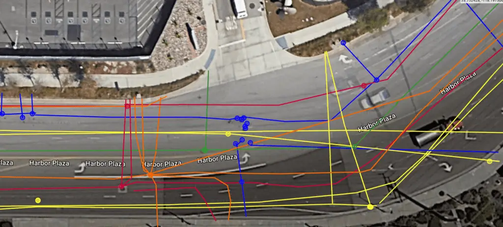
Utility mapping is the process of identifying and mapping underground utilities and structures. It’s like taking an x-ray of the ground to reveal the hidden infrastructure, such as water pipes, gas lines, electrical conduits, and more. This is essential for avoiding damage to these utilities during excavation and construction activities, ensuring safety, and preventing costly project delays.
Why Choose Professional Underground Utility Mapping Services?
- Safety: Knowing the exact location of underground utilities prevents accidents and injuries during construction.
- Cost Efficiency: Avoiding damage to utilities means avoiding expensive repairs and delays.
- Precision: Detailed maps allow for precise planning and execution, minimizing the risk of unexpected surprises.
- Regulatory Compliance: Ensuring all digging and excavation activities comply with local regulations and standards.
Our Advanced Approach
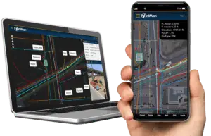
At 2M General Engineering, we utilize the latest technology and software to provide the most accurate and detailed subsurface maps. Here’s how we do it:
- Ground Penetrating Radar (GPR): GPR helps us see through the ground, providing detailed images of subsurface utilities.
- Electromagnetic Locating Tools: These tools help identify the precise location of metallic utilities.
- Trimble DA2 GNSS/GPS Equipment: This state-of-the-art equipment combined with error correction service ensures high accuracy in locating underground utilities
Certified Excellence
We are proud to be certified in using Pointman and CivilGrid underground utility mapping software.
Detailed Deliverables
Our utility mapping services come with comprehensive deliverables tailored to meet your specific needs:
- Formats: We provide maps in various formats, including PDFs, KMLs, CAD, and Civil 3D files, ensuring seamless integration into your project workflow.
- Accuracy: Our maps offer a clear, accurate view of underground utilities, allowing your team to plan and execute projects with confidence.
Economic Efficiency in Planning and Design
Unexpected subsurface obstacles can inflate project costs with unforeseen reroutes and redesigns. Our underground utility mapping minimizes these risks, detailing the underground landscape to streamline civil engineering efforts and safeguard your budget against costly surprises.
Why 2M General Engineering?
Choosing 2M General Engineering for your utility mapping needs means opting for:
- Precision: Our advanced equipment and certifications ensure the highest accuracy in gps utility mapping.
- Comprehensive Service: From PDFs to CAD formats, our deliverables are tailored to fit your project needs.
- Proactive Planning: Engaging our services in the planning phase helps avoid unforeseen utility conflicts and design cost overruns.
- Expertise: With years of utility mapping experience, we offer unmatched depth and detail in the industry.
Start Your Project with Confidence
2M General Engineering’s utility mapping service is more than just a service; it’s a crucial step in ensuring the success of your project. With 2M General Engineering, you can start your next project with the assurance that comes from the most detailed subsurface intelligence available.