Category :
Transportation
Description.
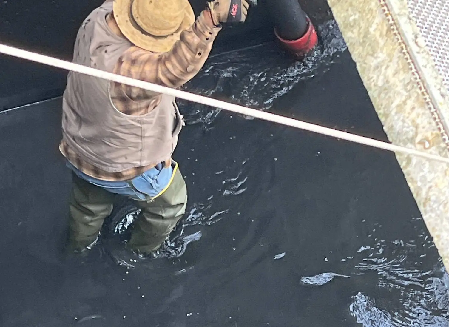
The 2M General Engineering hydrovac team was contracted to remove accumulated clam shells and sediment from water tanks and drainage ponds in Colusa County. Over time, debris buildup was reducing flow efficiency and causing potential maintenance issues. Using advanced vacuum excavation, we successfully cleared the tanks and ponds, restoring full functionality and preventing future blockages.


✅ All clams and sediment removed
✅ Major increase in water flow efficiency
✅ Tanks and ponds fully restored for continued use
✅ Minimal downtime for the client’s operations
“2M General Engineering did a fantastic job clearing our water tanks and drainage ponds. Their vacuum excavation process was quick and efficient, and they minimized disruption to our operations. We highly recommend their services for any reclamation or irrigation projects.”
-Jorge Jamie / Operations / Colusa County Water District
📞 Contact us today for a free consultation on tank cleaning, pond drainage, or vacuum excavation services.
916-237-7445
In the quiet expanse of the US Forest Service (USFS) Research Station, a groundbreaking project was unfolding, spearheaded by TWM and supported by the US Army Corps of Engineers. Our mission was clear: to locate and map approximately 16,000 feet of waterline while documenting over 90 features, and to perform strategic potholing at 70 crucial locations. This project was not just about updating maps; it was about paving the way for future conservation and infrastructure management.
The terrain of the USFS Research Station is a mosaic of densely wooded areas, posing significant challenges in terms of navigation and safety. The risk of fire was a constant concern, requiring us to implement rigorous fire prevention protocols and to ensure all equipment and personnel were meticulously cleaned before entering the protected areas. The objective was twofold: to preserve the pristine environment and to gather data with high precision to enhance the USFS’s existing infrastructure maps.
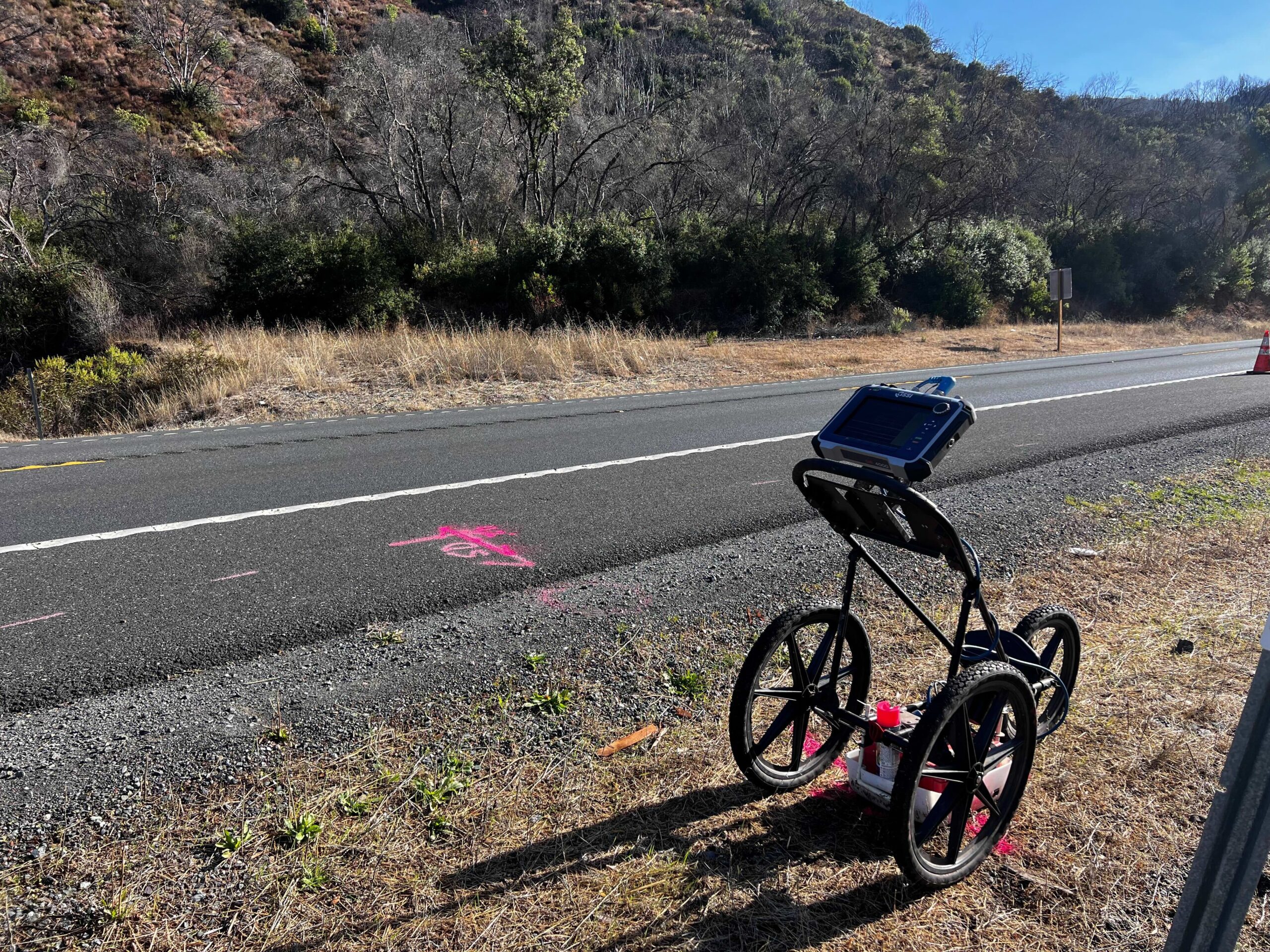
Our primary tools for underground utility locating were Ground Penetrating Radar (GPR) and Electromagnetic (EM) detection systems. These sophisticated technologies allowed us to peer beneath the earth’s surface, detecting hidden water lines and unseen features that lay buried under layers of soil and vegetation. However, GPR and EM have their limitations, particularly in areas dense with underground interferences or deep non-conductive materials. It was in these areas that we turned to potholing as a verification method, which allowed us to physically confirm the presence of underground utilities.
Given the vast expanse of the project, we planned the potholing in intervals to cover the entire area thoroughly. We completed a total of 70 test holes, which not only confirmed the data collected via GPR and EM but also provided physical samples and a direct look at the underground structures. This method ensured that no feature was left undocumented, maintaining the integrity and completeness of our survey.
The culmination of our fieldwork was the processing of the data collected. This involved generating fully processed xyz ASCII formatted files, which included detailed metadata such as point number, northing, easting, elevation, and description. All data was meticulously collected and compiled into an ESRI Geodatabase in compliance with the USACE SDSFIE 3.1.0 standards, ensuring the information was ready for integration into ArcGIS platforms. Furthermore, all GPR results and supporting documentation were prepared in both MicroStation and ESRI Shapefile formats, providing versatile options for future reference and use.
The comprehensive mapping and verification process undertaken at the USFS Research Station are set to significantly enhance the USFS’s ability to manage and maintain its water system infrastructure. By providing detailed documentation and updated geospatial data, we are not only supporting the USFS’s current needs but also empowering future conservation efforts and land management initiatives.
This project is a testament to the power of integrating technology with traditional field methods to achieve precision in environmental and infrastructure management. It underscores our commitment to advancing our understanding of the natural world while preserving its integrity for future generations.

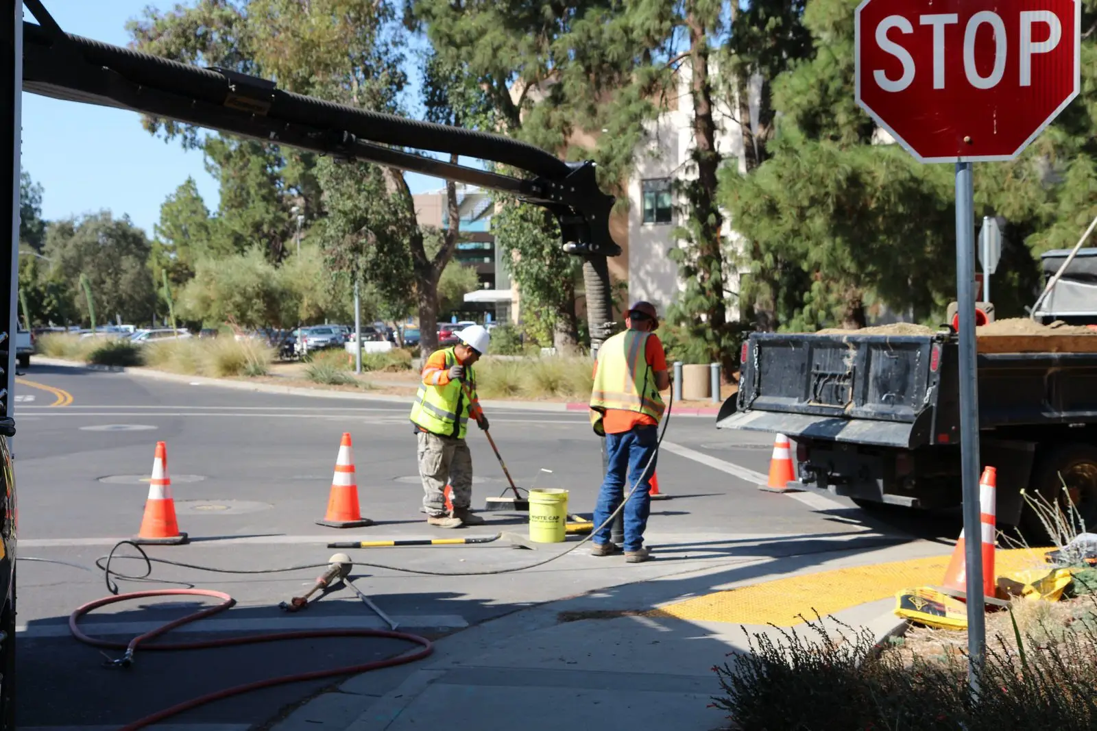
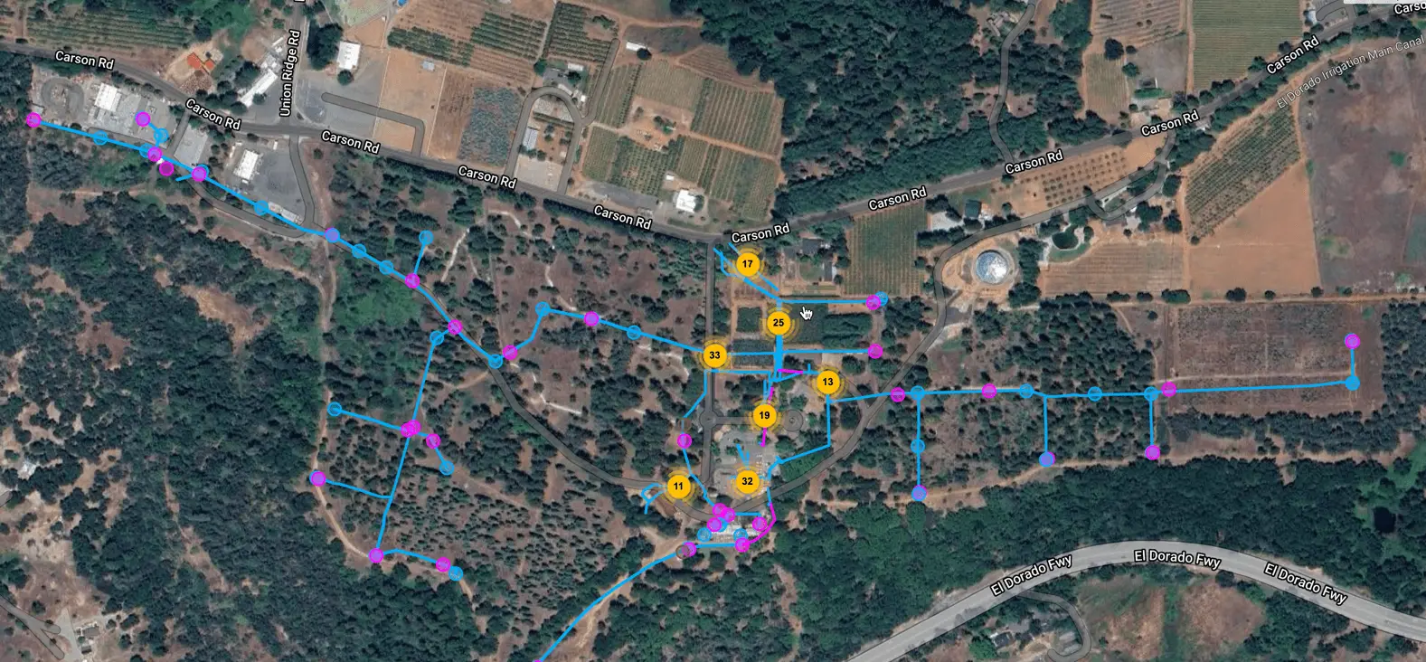
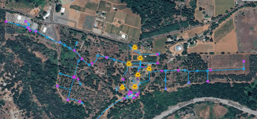
2M General Engineering undertook a pivotal six-week potholing project at UC Davis, focusing on the design phase of a new switch station and the execution of potholing operations. This case study captures the essence of the challenges faced, the strategic solutions implemented, and the seamless execution that led to the project’s success, complemented by a testimonial from our clients.
The active campus environment and the notably hard ground conditions presented significant challenges. The project required minimal disruption to the campus while dealing with the difficult digging conditions.
Our strategic approach included:
The project concluded triumphantly, with all objectives met within the stipulated timeframe. The final tally of potholes was 168, with 97 in hardscape/asphalt and 71 in landscape/dirt areas. The precision of our work is documented in the civil grid report, and the site was restored to its original condition, including repaving work where necessary.
2M General Engineering’s dedication to operational excellence shone throughout the UC Davis switch station project. Our proactive planning, adaptive strategies, and diligent execution ensured the project’s completion with minimal campus disruption and a testament to our commitment to quality and efficiency.